

 DE L’ÉGLISE
 DE L’ÉGLISE
 Verdun
Architects
Georges E. Lemay and Claude Leclerc

Artists

Start of service
September 3, 1978

Art & Architecture
The construction of this station was marred with unexpected difficulty. On March 20, 1974, the construction site caved in due to the weak surrounding bedrock. As a result, the station’s plan had to be hurriedly modified to deal with the weakness. As at Charlevoix, built in a similar rock formation, the station’s width was therefore reduced to a minimum.
Thus, instead of a conventional side-platform trainroom, the station has platforms on two different levels, fitted into a mined volume half as wide. On entering the station, the tracks diverge vertically, with the Honoré-Beaugrand tracks continuing above the Angrignon platform and the Angrignon tracks placed under the Honoré-Beaugrand platform. This is the only stacked-platform station in the network in which both platforms are positioned to the left of incoming trains.
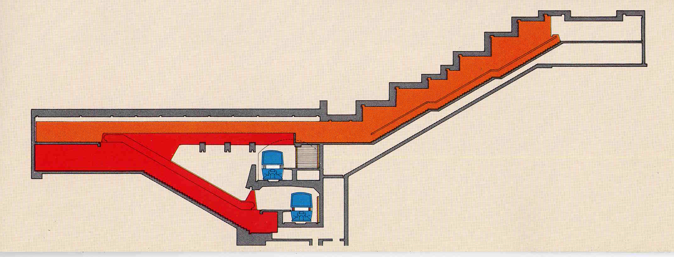

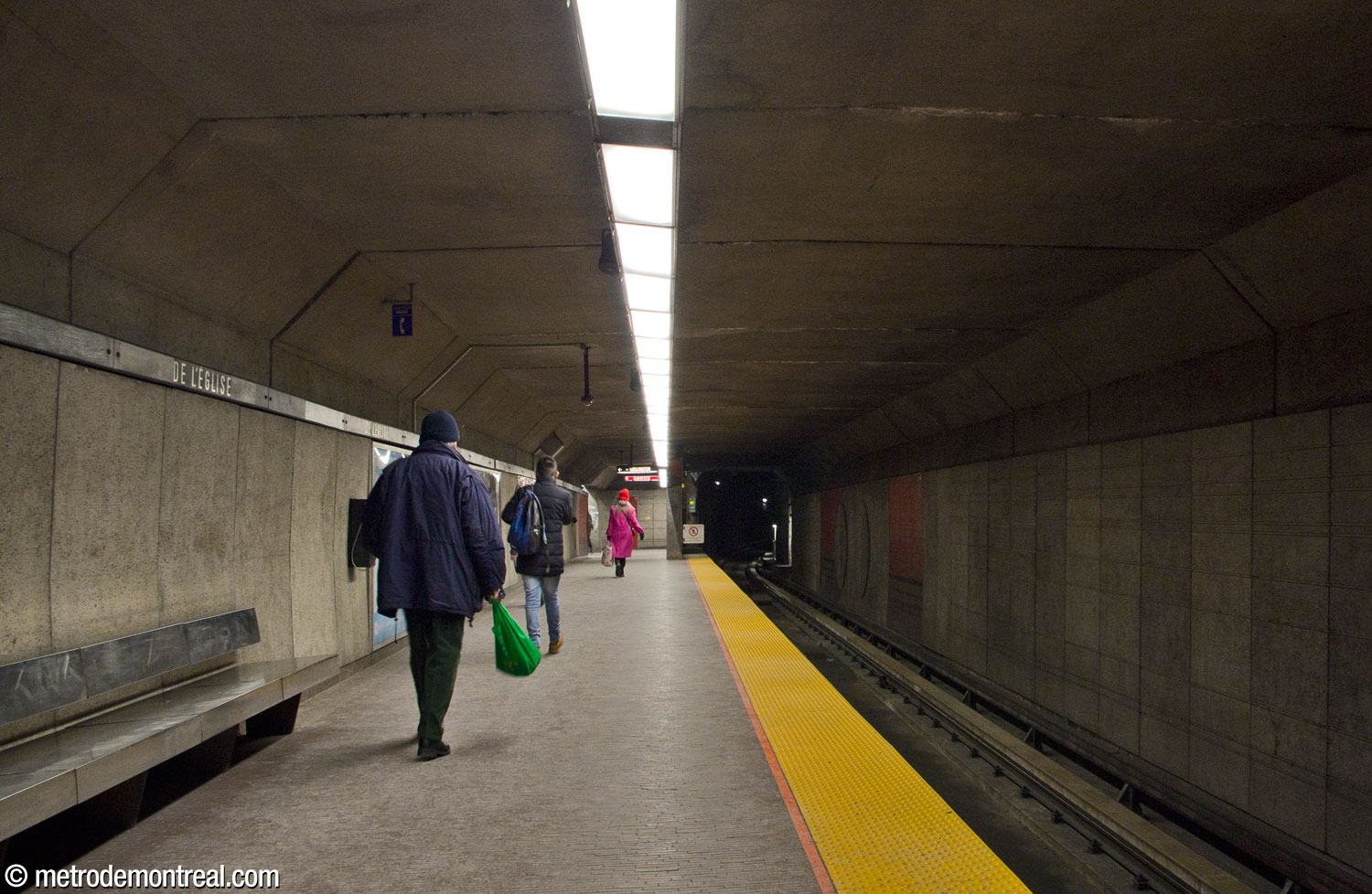
The accesses also had to be made more complex to reach the two different levels. The unfortunate result was a confusing and labyrinthine station, full of twists and turns.
There are two entrances, each connected to the platforms by long transepts. One is located a block away from the platforms, at the corner of Rue de l’Église and Rue Ross; it is connected to the station via a tunnel some 85 metres long, ending in a transept at the centre of the platforms.


The other, at the corner of Rue Galt and Rue Wellington, connects to the western end of the platforms.
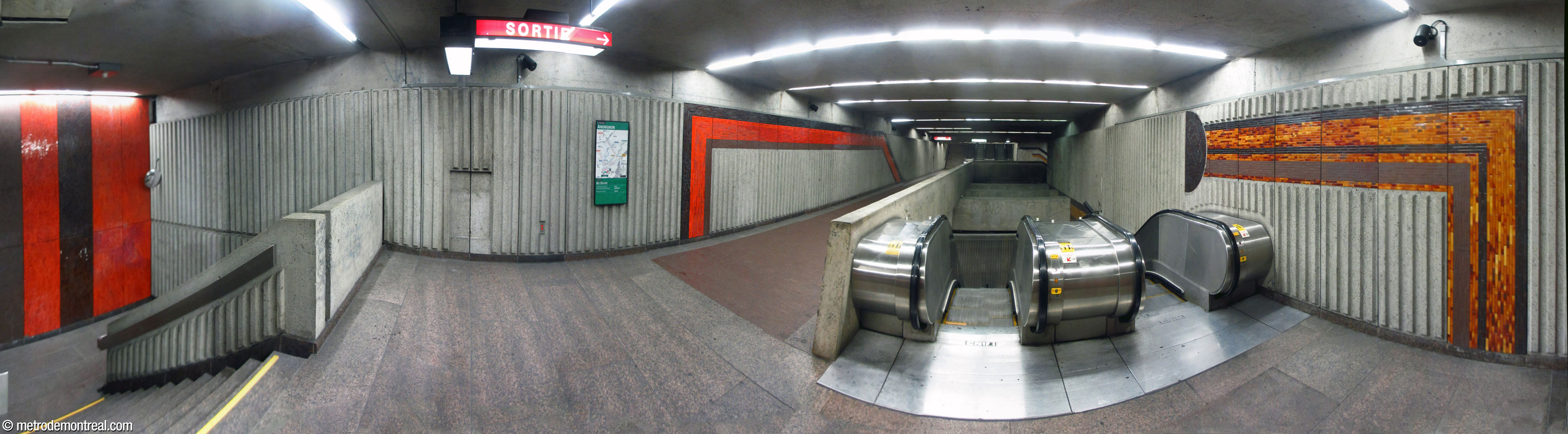


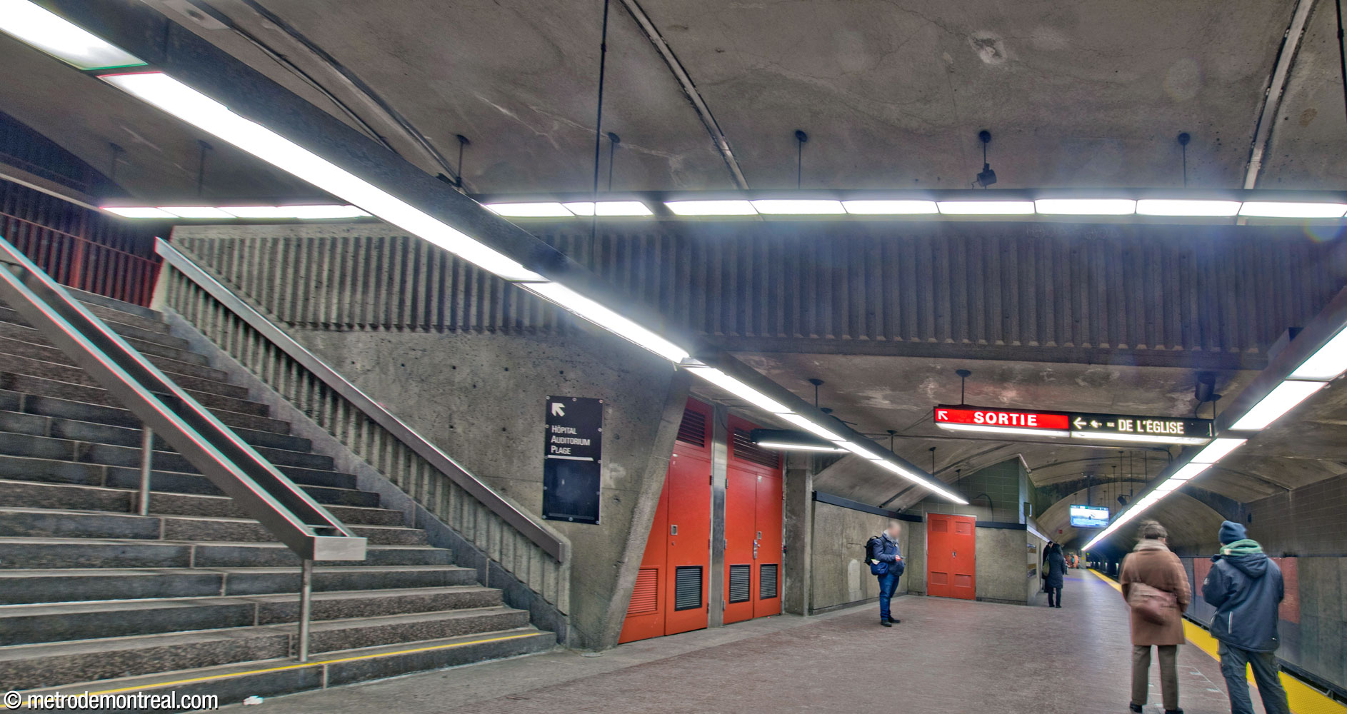
Each of the two transepts connects to a deep stairwell and escalator well leading down to the lower Angrignon platform, and a much shorter flight of stairs leading to the Honoré-Beaugrand platform. One unusual sight on the latter platform, underneath the transept leading to the De l’Église exit, is a maintenance area which is open to view, facing the platform across the track, and blocked off by only a railing.



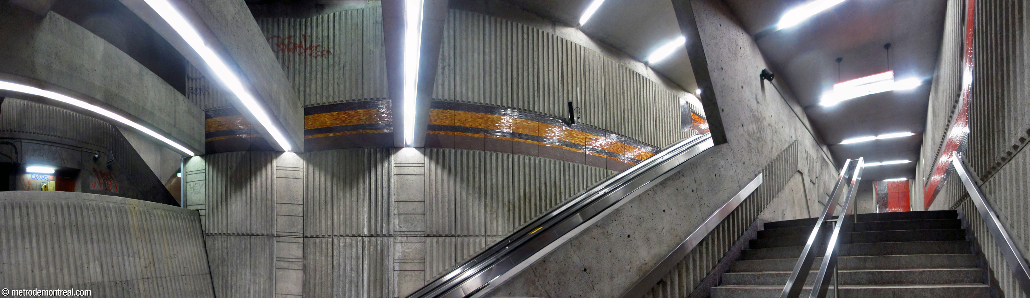
Unlike any other station, the staircases to the Angrignon platform are separated from the corresponding escalators. The stairwells are narrow, twisty, and claustrophobic, presenting a somewhat intimidating aspect. However, this arrangement does create some unique and interesting points of view not seen elsewhere in the network, notably in the Wellington access, where the stairs and escalators face openings onto the tracks, revealing trains speeding into and out of the station.




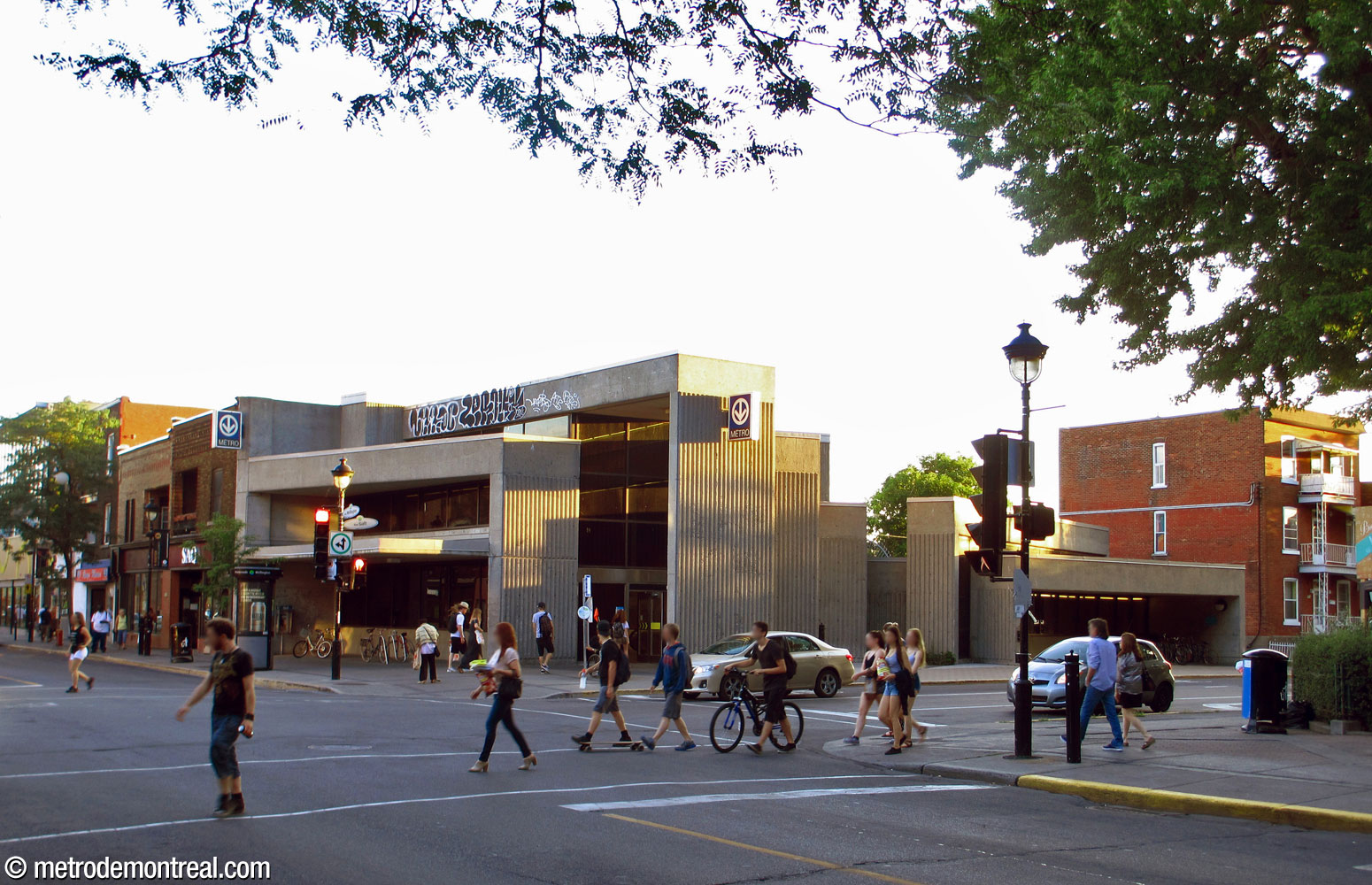
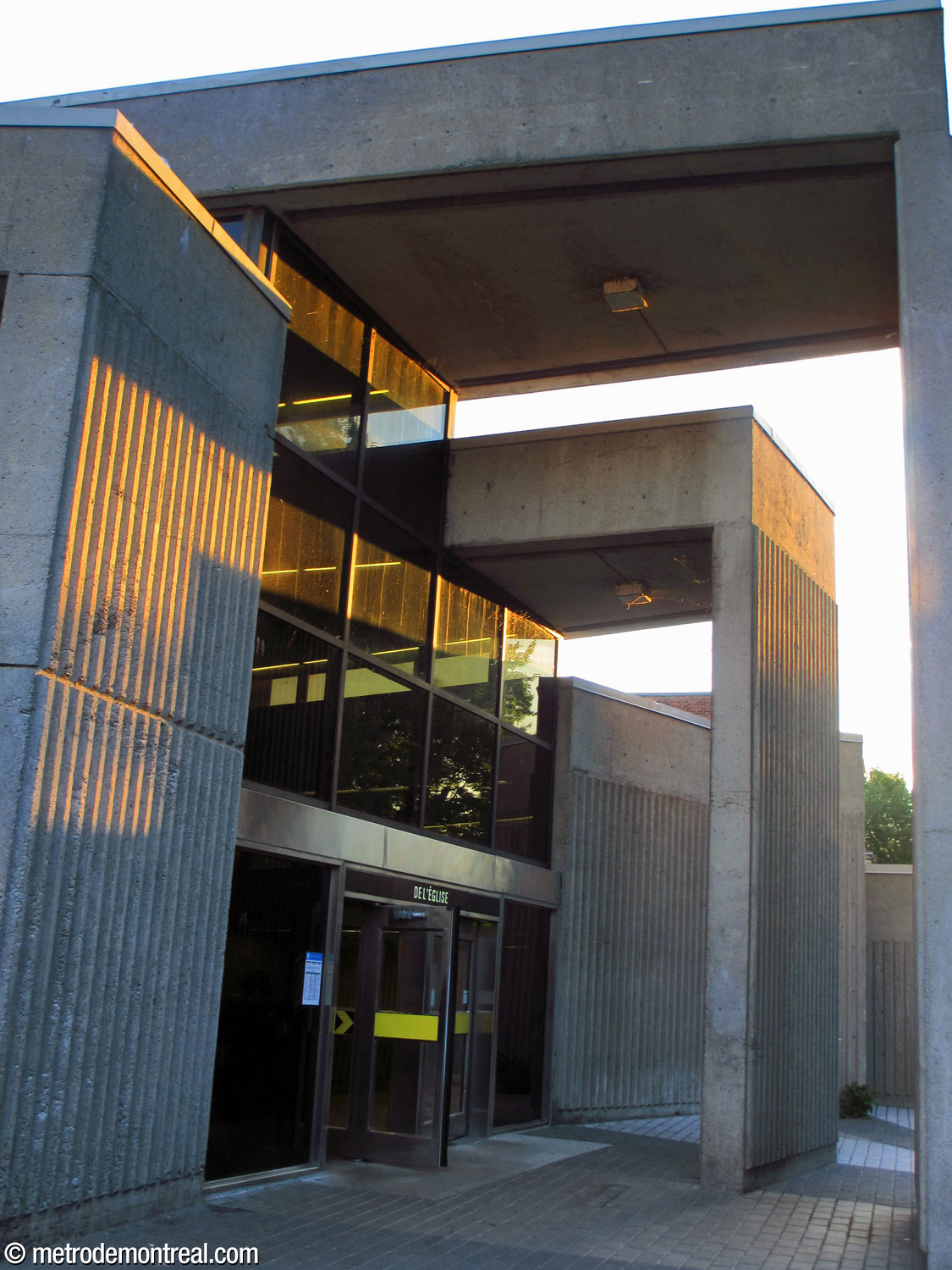
At street level, the headhouses are quite handsome and striking Brutalist structures in bare concrete and glass. They are made up of a series of nested masses of varying heights and widths defined by rectangular concrete arches projecting from a high side wall, each arch slightly rotated relative to the last. The concrete surfaces are connected by glass, forming clerestory windows that allow light through the concrete walls and emphasize the edges between the horizontal and vertical surfaces.2 The two largest arches in each headhouse have one wall shifted outward to shelter the main entrance.



The interior of the Wellington entrance has an open stairwell providing an attractive overlook onto the ticket hall below.


The station’s decoration is also a positive aspect. At ticket hall, transept, and platform levels, the walls are enhanced by stripes and circle motifs in brown, red, and ochre glazed ceramic tiles.


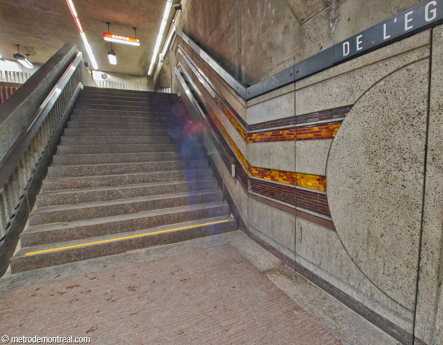


Moreover, bas-relief angular geometric friezes by Claude Théberge and Antoine D. Lamarche (similar to the same artists’ works at Verdun) enhance the all-concrete architecture of the upper levels. The reliefs can be seen in the interior of the headhouses and in the looming stepped blocks that form the ceiling above the escalators down to the transepts. They are also complemented by simpler designs in the walls of the rest of the station, pushing the integration of art and architecture further by blurring the boundaries between the station’s artwork and the rest of its decoration.2
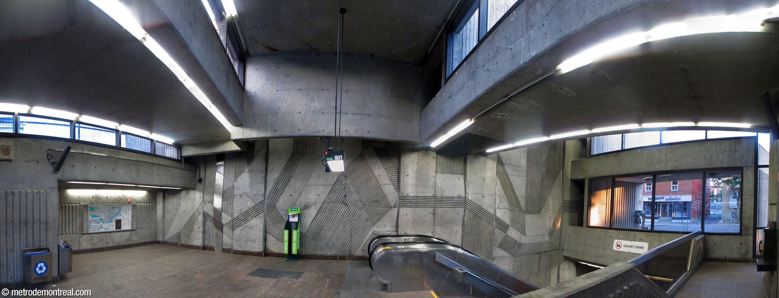


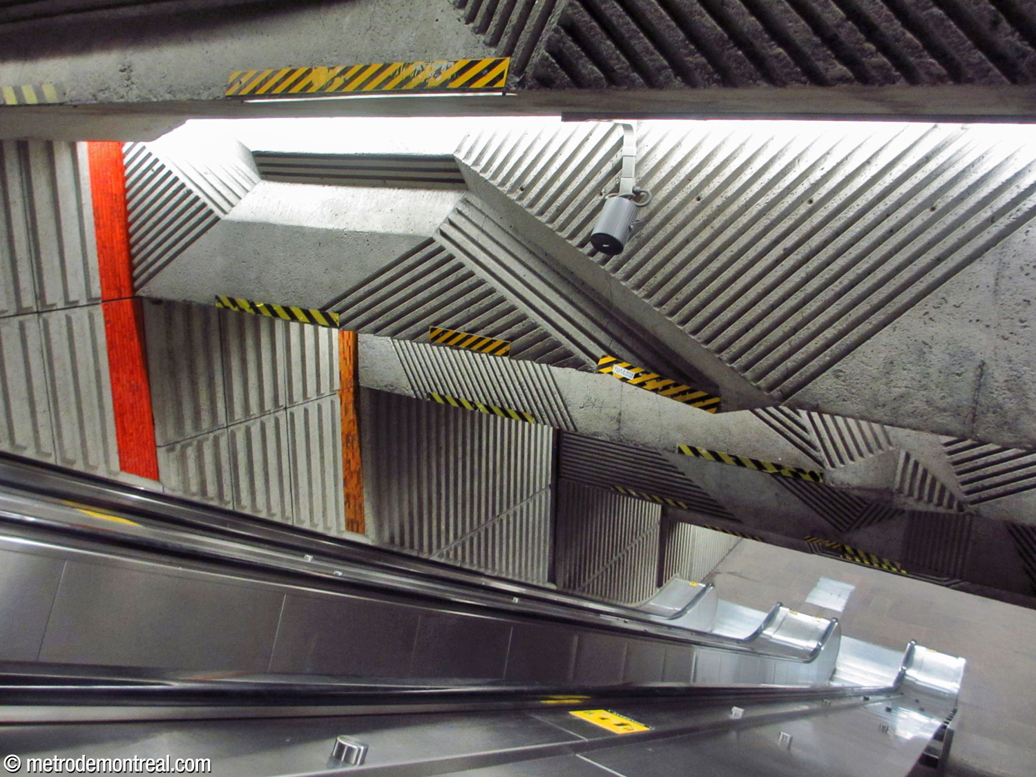
However, these areas are also not without their problems, such as low ceilings over the stairwells in the western entrance, which had to be cut with concrete saws to provide sufficient clearance. The architects’ task was certainly difficult, given the conditions and unexpected constraints; but the result is still unfortunate.

Accessibility
This station is not currently wheelchair-accessible. In the STM’s 2023-2032 capital expenditures program, this station was targeted for the installation of elevators by 2027, and the STM’s 2022 accessibility report indicated that planning for elevators was underway. However, the station no longer appears in the 2025-2034 capital program, due to budget cuts by the provincial government,3 and no construction work has yet been announced.
According to the Plan de développement d’accessibilité universelle de la STM 2012-2015 (p. 40), the predicted complexity of adding elevators at this station was rated as high (estimated cost over $18 million).
History & Trivia


Platform Depth
Honoré-Beaugrand platform: 19.8 m deep
Angrignon platform: 25.6 m deep
5th deepest station

Interstation Distances
To Verdun: 563.86 metres
To LaSalle: 812.30 metres
Origin of the Name
Rue de l’Église. This street is one of the oldest in the area. It first appears (namelessly) in an 1834 map as the only link between Côte Saint-Paul (now Rue Saint-Patrick) and Chemin de la Rivière-Saint-Pierre (now Boulevard LaSalle). It was subsequently known as Côte-Saint-Paul Road, Saint-Pierre Road, and Pavillion Road. Today, the portion in Verdun is officially Rue de l’Église, while the section in Côte-Saint-Paul is Avenue de l’Église.
It would be natural to assume that the station takes its name from the impressive Église Notre-Dame-des-Sept-Douleurs, which stands above the station in the heart of Verdun. However, the parish was created in 1899 and the first church was built on this site in 1900 (the present church was built in 1914). But the name Church Avenue had already appeared in Verdun before it was built: in listings for Verdun in Lovell’s Montreal Directory by 1897, and in maps by 1898.4
Instead, the name derives from Église Saint-Paul, 1.5 km away in Côte-Saint-Paul. The first church was built in 1876, and had given its name to “Church Road” at least in Côte-Saint-Paul by 1890.5
Église Saint-Paul was struck by lightning and burned down in 1899; rebuilt in 1900, it burned down again in 1907 and was rebuilt once more in 1910-11. Designed by architect Joseph Arthur Godin, it contained windows by renowned stained glass artist Guido Nincheri. The church was included in the Côte-Saint-Paul heritage site, designated by the city in 1991.6, 7 The parish was later merged with that of Cœur-Immaculée-de-Marie, and the church burned down in February 2026.8
Former alternative names: Église9, Avenue-de-L’Église (printed on official network maps from 1982 to 1986).

1898 map showing Church Avenue (today’s rue de l’Église), prior to the construction of Église Notre-Dame-des-Sept-Douleurs
(Source10)

Église Saint-Paul in 2021
Trivia

A 1983 CTCUM map showing the station’s name as Avenue-de-L’Église
(Source11)
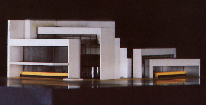
Maquette of the Rue Wellington headhouse
(Source12)
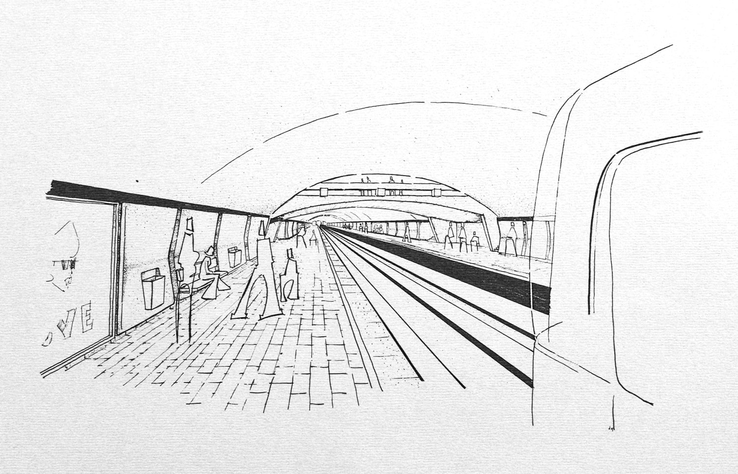
Architect’s rendering of De l’Église station, showing original side-platform design
(Source13)
-
The station construction site suffered a severe cave-in on March 20, 1974. At this point, the concrete vault had not yet been poured, so the rock above the station was being supported by metal braces. Also, excavation had begun on the wider trainroom vault, and braces had yet to be installed. Finally, the snow was thawing, increasing the amount of groundwater.
- On the day of the incident, around 11 a.m., dynamiting caused the weak rock above the station to crack, and the metal braces supporting it to begin to shift severely. The worksite was evacuated. A few hours later, the roadway (which had been open to traffic during the construction) abruptly began to shudder, bulge, and subside. Finally, at about 2:15 p.m., a section of Rue Wellington east of Rue de l’Église collapsed, creating a hole some 21 metres deep and some 25 metres long. The whole area was evacuated, due both to the resulting gas leak from destroyed conduits, and to fears for the stability of nearby buildings. In the end, the entire pit was filled in with crushed rock in order to stop any further landslides. Fortunately, nobody was injured and no other buildings collapsed.2, 14
- The cave-in was due in part to the station’s being built in an area of comparatively weak shales of the Utica and Nicolet formations, compared to the stronger limestones (Trenton and Chazy) found elsewhere in the island.15 Following the accident, the plans for the station were modified to halve the width of the trainroom by using stacked platforms, to reduce the overburden that would have to be supported during excavation. Charlevoix station’s plans were also modified in consequence. Other stations in the same rock formation, including Verdun and LaSalle, are built cut-and-cover; De l’Église had been planned to be built in tunnel so as not to disrupt business on Rue Wellington with the needed excavations.2
- The accident delayed the opening of the extension from 1976 to 1978, and also forced the closure of the affected portion of Rue Wellington while work in that section continued in open cut; however, the rest of the trainroom was still built in tunnel.2 Local merchants responded to the drop in business by holding a sidewalk sale in the remaining portions of the street, including a tightrope walker who traversed the construction pit.
- Other smaller cave-ins troubled the rest of the construction. In the rush to finish the station for the new deadline of September 3, 1978, the Rue de l’Église exit was not completed in time; the station used only the Rue Wellington exit until 1979.
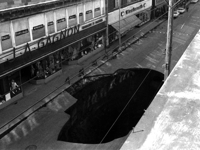
The sinkhole left in Rue Wellington
(Source12)
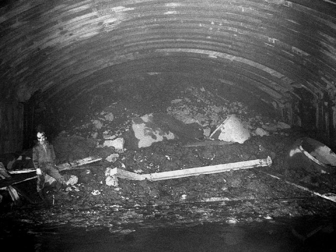
View inside the station excavation after the cave-in
(Source12)
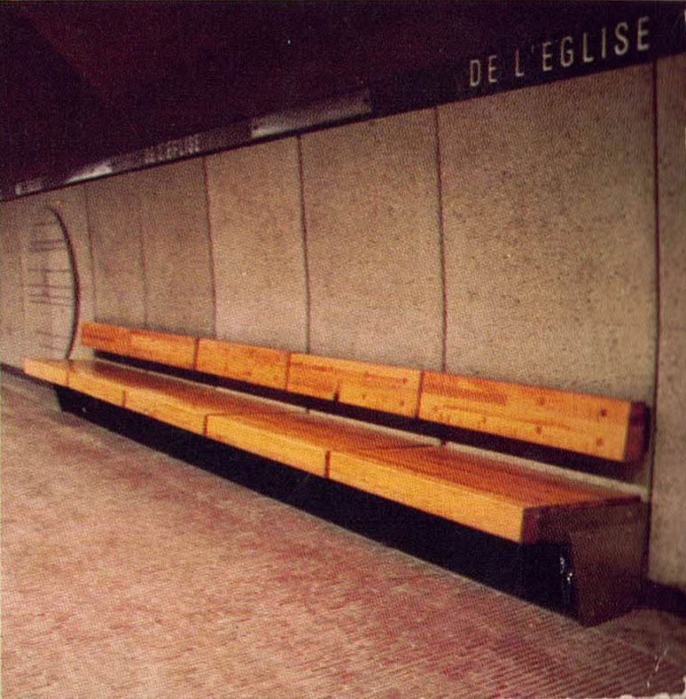
The station’s wooden benches before they were covered with metal sheets
(Source16)
General Information
Platform diagram
Most convenient metro cars to use when travelling to this station
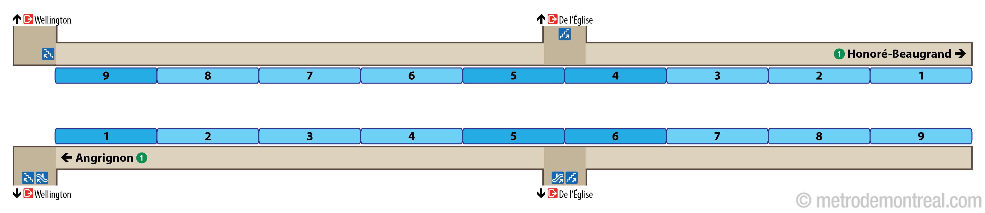
Station surroundings


Station address
Borough of Verdun
Wellington entrance: 250 Rue Galt, at Rue Wellington
De l’Église entrance: 133 Rue de l’Église, at Rue Ross (unstaffed)
Nearby attractions
- Verdun Beach
- Verdun Auditorium
- Hôpital de Verdun
- CLSC de Verdun
- Église Notre-Dame-des-Sept-Douleurs
- Parc Arthur-Therrien (Verdun waterfront)
Official website
Service information, opening hours, frequency, bus routes

Most recent update: October 8, 2026
References
- Image source: Bureau de transport de Montréal. (1978). [Untitled booklet on the 1978 green line extension.] Montreal: BTM. P. 15. ↩
- Senosier Roberge, Véronique (producer). (2019, September 23). "Station de l'Église" [TV series episode]. Le métro voyage dans le temps. MAtv Montréal. ↩ ↩ ↩ ↩ ↩
- Ouellette-Vézina, Henri. (2025, April 16). “Faute de financement: L’installation d’ascenseurs encore à l’arrêt dans le métro.” La Presse. ↩
- Lovell’s Montreal Directory for 1897-98. (1897). Montreal: John Lovell & Son. Bibliothèque et Archives nationales du Québec, 0005993752. See p. 164 (“A street directory of Montreal,” s.v. “Church av.”), and, e.g., p. 729 (“Alphabetical directory,” s.v. “Hickin, G.T.”). See also Goad (1898), below. ↩
- Goad, C.E. (1890). Atlas of the City of Montreal from special survey and official plans, showing all buildings & names of owners. Montreal: author. Plate 61. Bibliothèque et Archives nationales du Québec, 0000174398. ↩
- Paré, O. (2017). “Le site patrimonial de Côte-Saint-Paul.” Mémoires des Montréalais. Centre d’histoire de Montréal. ↩
- Conseil du patrimoine religieux du Québec. (2020). “Église Saint-Paul.” Patrimoine des lieux de culte du Québec. ↩
- Benessaieh, Karim. (2026, February 23.) “Côte-Saint-Paul: Une ancienne église a été ravagée par les flammes.” La Presse. ↩
- Communauté urbaine de Montréal. (1989). Tour toponymique : Les stations de métro. Montreal: author. ↩
- Image adapted from: Goad, C.E. (1898). Map of the city of Montreal [map]. Montreal: author. Bibliothèque et Archives nationales du Québec, E21,S555,SS1,SSS21,P6. ↩
- Image source: CTCUM. (1983, January). Plan du réseau C.T.C.U.M. Bibliothèque et Archives nationales du Québec, 0006813063. ↩
- © STM archives. ↩ ↩ ↩
- Image source: Lemay-Leclerc, architectes. De l'Église (presentation document for the Bureau de transport métropolitain). c. 1973. Archives de la Ville de Montréal, dossier CA M001 XCD001-D19, item 1D-06-01-01F. P. 13. ↩
- Chartier, R. (1974, March 21). “L’effondrement retardera le prolongement du métro.” La Presse, p. A3. ↩
- Thériault, R. (2014). Géologie des basses-terres du Saint-Laurent [map]. Quebec City: Ministère de l’Énergie et des Ressources naturelles. ↩
- Image source: Bureau de transport métropolitain. (1983). “De l’Église” [pamphlet]. ↩